k38. German Gun
sites in the inland (Vest-Agder/Norway)
k31 kystfort rundt Kristiansand
k32 kystfort på strekningen Søgne-Lyngdal
k33 kystfort på strekningen Farsund-Flekkefjord
k34 Batt. Vara
k35 ikke brukt
k39 diverse innsamlete bilder og filer til senere bruk,
monumenter for nøytralitetsvakt 1914-1915
k61 German radio link stations
k62 Gerrman
telecommunication equipment
K89.
Kystvakthytter/Coast Guard cottages
After the request I travelled 150km forth and
back so visit Knaben area where I knew it had been lot of English
bombers
during the war and and heavy German artillery, talked to a native
and he told me a place to look, but he said the road was not
open, so I did "like German tourists" and had
a chance to follow a car through the otherwise locked gate, and
pleased to discover
that it was open when I returned - only because Red Cross
had a rescue operation during the last days and had to go and
collect
a transmitter on a mountain top further up when missed person was
found.[2003.07.07]
On the road between Knaben and Kvina Gruver I found two gun
sites, 75km north of Lindesnes
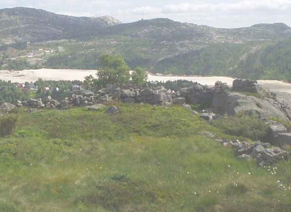
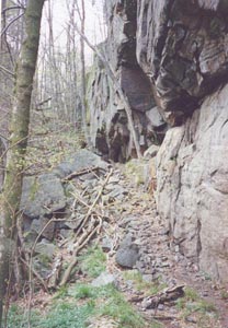
(1) at UTM 3.87.400E 65.05.700N - 720m asl (über Meere Spiegel)
and
It is quite usual walls, but very little concrete is used. You
see Knaben Gruver in the background. The picture is taken towards
east-south-east.
Very little infra-strcture was found, only a possible aggregat
place on the side of the site, and 1m high stone walls for what
could have been a
building behind the gun site (on the mountain side).
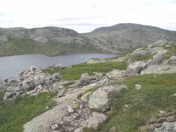
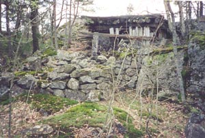
(2) at UTM 3.87.800E 65.06.500N. - 820m asl. It was difficult to
find also because it has been much molybden mining around
and most traces of mankind has nothing to do with the war. It has
been no use of concrete - only that stones were spread out
from the road up towards the hill to make transport easier
indicated that it was something to investigate further.
The picture is taken towards north-west. Absolutely no sign of
infra structure was seen.
The mountain you see in the background (right side) is
Grunnevassknuten 971m asl), and to the left is Storafjellet, the
water is Sandtjörn.
You walk on the Knaben-Kvina road to the cross where the old road
to Knaben I starts. It was some a path marked Knaben I near
Knaben,
but this road is not on my map so I cannot tell if it stops at
Reinshommen or Finndalsvatnet, so the rest is possibly only
footpath. The road
I used is very bad, even along the water behind Knaben where it
is some cottages, so don't try to go further - not even possible
for my Volvo!
I doubt very much that these were the only German positions
around Knaben, possibly also some around Kvina Gruver. I didn't
walk farther
because it started to be overcasted and I don't like to walk in
mountains if it is a thunderstom which it is quite frequently in
some inland areas
Rossevann
(Vågsbygd/Søgne/Songdalen)
Russian prisoner had very
much work to build a road on the north side of Rossevann, here
a detail from Monte Rosso.
 |
 |
WW1 site at
Rosseland, still used in WW2
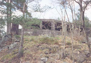
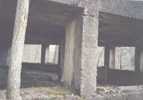
German site at Svarvestolen
(Sögne), somewhat difficult to find suitable
motives and angles for photographing
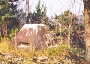
Brennaasen, Songdalen. Observation post, called
"Kleinstglocke"
= small cupular for infanterie observation.


2003.07.07